
Wellsville topographic map
Interactive map
Click on the map to display elevation.
About this map
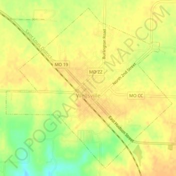
Name: Wellsville topographic map, elevation, terrain.
Average elevation: 807 ft
Minimum elevation: 735 ft
Maximum elevation: 837 ft
Other topographic maps
Click on a map to view its topography, its elevation and its terrain.
New Florence
United States > Missouri > Montgomery County
New Florence, Montgomery County, Missouri, United States
Average elevation: 850 ft
Bluffton
United States > Missouri > Montgomery County
Bluffton, Montgomery County, Missouri, United States
Average elevation: 607 ft
Jonesburg
United States > Missouri > Montgomery County
Jonesburg, Montgomery County, Missouri, United States
Average elevation: 869 ft