
Mougheul topographic map
Interactive map
Click on the map to display elevation.
About this map
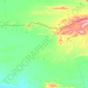
Name: Mougheul topographic map, elevation, terrain.
Location: Mougheul, Daïra de Lahmar, Béchar, Algérie (31.97592 -2.33517 32.18218 -1.90824)
Average elevation: 3,501 ft
Minimum elevation: 2,730 ft
Maximum elevation: 5,860 ft