
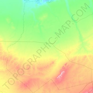
Kef El Ahmar topographic map
Interactive map
Click on the map to display elevation.
About this map
Name: Kef El Ahmar topographic map, elevation, terrain.
Location: Kef El Ahmar, Daïra Rogassa, El Bayadh, Algérie (33.60044 0.38771 34.06899 0.91580)
Average elevation: 3,829 ft
Minimum elevation: 3,241 ft
Maximum elevation: 5,049 ft