
Thank you for supporting this site ❤️
Make a donation
Make a donation
Gear up for your next adventure:
As an Amazon Associate, this site earns from qualifying purchases at no extra cost to you.
Bolgheri topographic map
Click on the map to display elevation.
Thank you for supporting this site ❤️
Make a donation
Make a donation
Gear up for your next adventure:
As an Amazon Associate, this site earns from qualifying purchases at no extra cost to you.
About this map
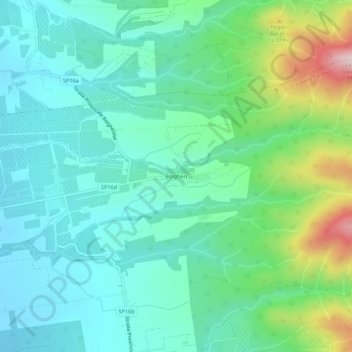
Name: Bolgheri topographic map, elevation, terrain.
Location: Bolgheri, Castagneto Carducci, Livorno, Tuscany, 57020, Italy (43.21401 10.59793 43.25401 10.63793)
Average elevation: 361 ft
Minimum elevation: 89 ft
Maximum elevation: 1,211 ft
Thank you for supporting this site ❤️
Make a donation
Make a donation
Gear up for your next adventure:
As an Amazon Associate, this site earns from qualifying purchases at no extra cost to you.