
Zambujal topographic map
Interactive map
Click on the map to display elevation.
About this map
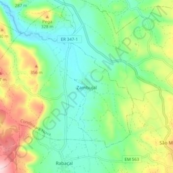
Name: Zambujal topographic map, elevation, terrain.
Location: Zambujal, Condeixa-a-Nova, Coimbra, Portugal (40.02977 -8.49677 40.08130 -8.42640)
Average elevation: 814 ft
Minimum elevation: 440 ft
Maximum elevation: 1,604 ft
Other topographic maps
Click on a map to view its topography, its elevation and its terrain.
Portela
Portugal > Coimbra > Condeixa-a-Nova
Portela, Sebal e Belide, Condeixa-a-Nova, Coimbra, 3150-289, Portugal
Average elevation: 164 ft
Condeixa-a-Velha
Portugal > Coimbra > Condeixa-a-Nova
Condeixa-a-Velha, Condeixa-a-Nova, Coimbra, 3150-220, Portugal
Average elevation: 361 ft