
Douliu City topographic map
Interactive map
Click on the map to display elevation.
About this map
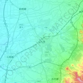
Name: Douliu City topographic map, elevation, terrain.
Location: Douliu City, Yunlin County, Taiwan (23.65058 120.49534 23.76006 120.64826)
Average elevation: 203 ft
Minimum elevation: 69 ft
Maximum elevation: 1,106 ft
Other topographic maps
Click on a map to view its topography, its elevation and its terrain.
Wujiancuo
Taiwan > Yunlin County > Huwei Township
Wujiancuo, Xi'an Village, Huwei Township, Yunlin County, 63201, Taiwan
Average elevation: 82 ft