
Thank you for supporting this site ❤️
Make a donation
Make a donation
Gear up for your next adventure:
As an Amazon Associate, this site earns from qualifying purchases at no extra cost to you.
Göreme topographic map
Click on the map to display elevation.
Thank you for supporting this site ❤️
Make a donation
Make a donation
Gear up for your next adventure:
As an Amazon Associate, this site earns from qualifying purchases at no extra cost to you.
About this map
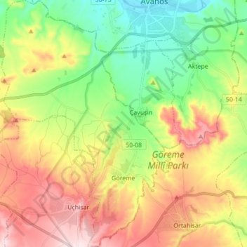
Name: Göreme topographic map, elevation, terrain.
Location: Göreme, Nevşehir, Central Anatolia Region, Turkey (38.61212 34.76149 38.71913 34.85785)
Average elevation: 3,668 ft
Minimum elevation: 3,015 ft
Maximum elevation: 4,547 ft
Thank you for supporting this site ❤️
Make a donation
Make a donation
Gear up for your next adventure:
As an Amazon Associate, this site earns from qualifying purchases at no extra cost to you.