
Ürikon topographic map
Interactive map
Click on the map to display elevation.
About this map
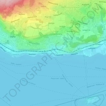
Name: Ürikon topographic map, elevation, terrain.
Location: Ürikon, Stäfa, Bezirk Meilen, Zürich, 8713, Schweiz (47.21506 8.73738 47.25506 8.77738)
Average elevation: 1,457 ft
Minimum elevation: 1,319 ft
Maximum elevation: 2,031 ft