
Lxivya topographic map
Interactive map
Click on the map to display elevation.
About this map
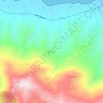
Name: Lxivya topographic map, elevation, terrain.
Location: Lxivya, Azeffoun, Daïra Azeffoun, Tizi Ouzou, 15045, Algérie (36.85206 4.36512 36.89206 4.40512)
Average elevation: 922 ft
Minimum elevation: -3 ft
Maximum elevation: 2,474 ft