
Saint George Basseterre topographic map
Interactive map
Click on the map to display elevation.
About this map
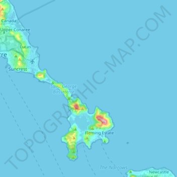
Name: Saint George Basseterre topographic map, elevation, terrain.
Location: Saint George Basseterre, Saint Kitts, Saint Kitts and Nevis (17.21281 -62.75512 17.32563 -62.60992)
Average elevation: 20 ft
Minimum elevation: -7 ft
Maximum elevation: 1,001 ft
Other topographic maps
Click on a map to view its topography, its elevation and its terrain.
Half Way Tree
Saint Kitts and Nevis > Saint Kitts
Half Way Tree, Saint Thomas Middle Island, Saint Kitts, Saint Kitts and Nevis
Average elevation: 459 ft