
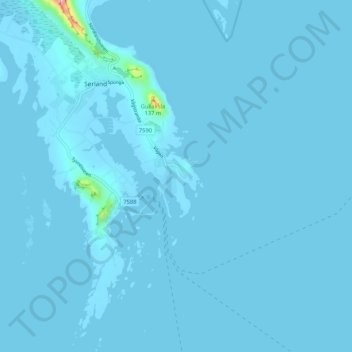
Røssnesvågen topographic map
Interactive map
Click on the map to display elevation.
About this map
Name: Røssnesvågen topographic map, elevation, terrain.
Location: Røssnesvågen, Sørland, Værøy, Nordland, 8063, Norvège (67.63498 12.70182 67.67498 12.74182)
Average elevation: 10 ft
Minimum elevation: -7 ft
Maximum elevation: 646 ft