
Gschwendt topographic map
Interactive map
Click on the map to display elevation.
About this map
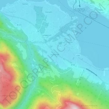
Name: Gschwendt topographic map, elevation, terrain.
Average elevation: 2,139 ft
Minimum elevation: 1,732 ft
Maximum elevation: 3,780 ft
Other topographic maps
Click on a map to view its topography, its elevation and its terrain.
Postalm
Österreich > Salzburg > Bezirk Salzburg-Umgebung > Strobl > Lochalm
Postalm, Lochalm, Strobl, Bezirk Salzburg-Umgebung, Salzburg, 5350, Österreich
Average elevation: 4,301 ft
Strobl
Österreich > Salzburg > Bezirk Salzburg-Umgebung > Strobl
Strobl, Bezirk Salzburg-Umgebung, Salzburg, 5350, Österreich
Average elevation: 3,278 ft