
Callignee topographic map
Interactive map
Click on the map to display elevation.
About this map
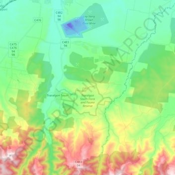
Name: Callignee topographic map, elevation, terrain.
Average elevation: 620 ft
Minimum elevation: -210 ft
Maximum elevation: 1,978 ft
Other topographic maps
Click on a map to view its topography, its elevation and its terrain.
Loy Yang Creek
Australia > Victoria > Traralgon
Loy Yang Creek, Traralgon, Latrobe City, Victoria, 3844, Australia
Average elevation: 135 ft
Sheepwash Creek
Australia > Victoria > Traralgon
Sheepwash Creek, Traralgon, Latrobe City, Gippsland, Victoria, Australia
Average elevation: 108 ft