
Laguna Maquera topographic map
Interactive map
Click on the map to display elevation.
About this map
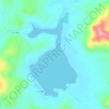
Name: Laguna Maquera topographic map, elevation, terrain.
Location: Laguna Maquera, PU-1088, Cabanillas, San Román, Puno, Perú (-15.88420 -70.56895 -15.86314 -70.55581)
Average elevation: 13,796 ft
Minimum elevation: 13,684 ft
Maximum elevation: 14,232 ft
Other topographic maps
Click on a map to view its topography, its elevation and its terrain.
Laguna Saracocha
Perú > Puno > Cabanillas
Laguna Saracocha, PE-34C, Cabanillas, San Román, Puno, Perú
Average elevation: 13,881 ft
Laguna Saytococha
Perú > Puno > Cabanillas
Laguna Saytococha, PU-1091, Cabanillas, San Román, Puno, Perú
Average elevation: 14,016 ft