
Hidaj City topographic map
Interactive map
Click on the map to display elevation.
About this map
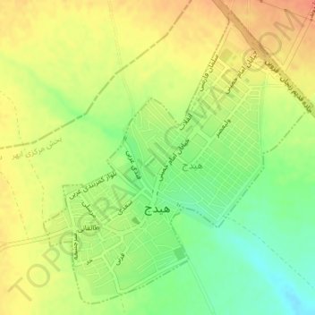
Name: Hidaj City topographic map, elevation, terrain.
Average elevation: 5,361 ft
Minimum elevation: 5,282 ft
Maximum elevation: 5,423 ft
Other topographic maps
Click on a map to view its topography, its elevation and its terrain.
Hidaj
Iran > Zanjan Province > Abhar County > دهستان صائین قلعه
Hidaj, دهستان صائین قلعه, بخش مرکزی شهرستان ابهر, Abhar County, Zanjan Province, Iran
Average elevation: 5,413 ft