
Paradela topographic map
Interactive map
Click on the map to display elevation.
About this map
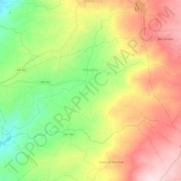
Name: Paradela topographic map, elevation, terrain.
Location: Paradela, Chaves, Vila Real, Alto Tâmega, Norte, Portugal (41.79159 -7.36715 41.81634 -7.31029)
Average elevation: 2,356 ft
Minimum elevation: 1,663 ft
Maximum elevation: 3,015 ft
Other topographic maps
Click on a map to view its topography, its elevation and its terrain.