
A Pedreira topographic map
Interactive map
Click on the map to display elevation.
About this map
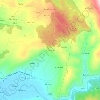
Name: A Pedreira topographic map, elevation, terrain.
Location: A Pedreira, Láncara, Sarria, Lugo, Galicia, 27367, España (42.85726 -7.35627 42.89726 -7.31627)
Average elevation: 1,818 ft
Minimum elevation: 1,322 ft
Maximum elevation: 2,543 ft
Other topographic maps
Click on a map to view its topography, its elevation and its terrain.
Castrodelo
España > Galicia > Sarria > Láncara > Castrodelo
Castrodelo, Cedrón, Láncara, Sarria, Lugo, Galicia, 27692, España
Average elevation: 2,195 ft