
Gees topographic map
Interactive map
Click on the map to display elevation.
About this map
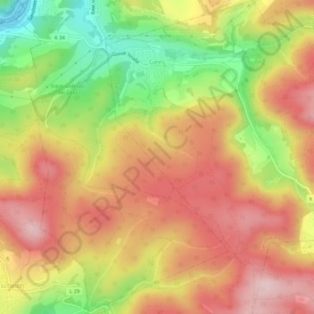
Name: Gees topographic map, elevation, terrain.
Average elevation: 1,663 ft
Minimum elevation: 1,188 ft
Maximum elevation: 2,014 ft
Other topographic maps
Click on a map to view its topography, its elevation and its terrain.
Niedereich
Duitsland > Rijnland-Palts > Landkreis Vulkaneifel > Gerolstein > Büscheich > Niedereich
Niedereich, Büscheich, Gerolstein, Landkreis Vulkaneifel, Rijnland-Palts, 54568, Duitsland
Average elevation: 1,568 ft