
Cotton Relief 1 topographic map
Interactive map
Click on the map to display elevation.
About this map
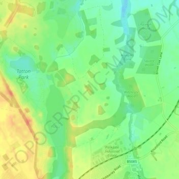
Name: Cotton Relief 1 topographic map, elevation, terrain.
Average elevation: 164 ft
Minimum elevation: 98 ft
Maximum elevation: 246 ft
Other topographic maps
Click on a map to view its topography, its elevation and its terrain.
Middlewich
Royaume-Uni > Angleterre > Cheshire East
Middlewich, Cheshire East, Angleterre, Royaume-Uni
Average elevation: 131 ft
Cranage
Royaume-Uni > Angleterre > Cheshire East
Cranage, Cheshire East, Angleterre, Royaume-Uni
Average elevation: 171 ft
Nantwich
Royaume-Uni > Angleterre > Cheshire East
Nantwich, Cheshire East, Angleterre, Royaume-Uni
Average elevation: 148 ft