
Beagle topographic map
Interactive map
Click on the map to display elevation.
About this map
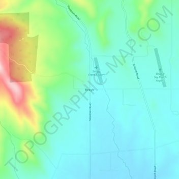
Name: Beagle topographic map, elevation, terrain.
Location: Beagle, Jackson County, Oregon, États-Unis d'Amérique (42.51457 -122.94532 42.55457 -122.90532)
Average elevation: 1,532 ft
Minimum elevation: 1,306 ft
Maximum elevation: 2,241 ft
Other topographic maps
Click on a map to view its topography, its elevation and its terrain.
Medford
États-Unis d'Amérique > Oregon > Jackson County
Medford, Jackson County, Oregon, États-Unis d'Amérique
Average elevation: 1,447 ft
Ashland
États-Unis d'Amérique > Oregon > Jackson County
Ashland, Jackson County, Oregon, États-Unis d'Amérique
Average elevation: 2,539 ft