
Romanshorn topographic map
Interactive map
Click on the map to display elevation.
About this map
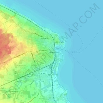
Name: Romanshorn topographic map, elevation, terrain.
Location: Romanshorn, Bezirk Arbon, Thurgovie, 8590, Suisse (47.54954 9.32615 47.58084 9.38559)
Average elevation: 1,322 ft
Minimum elevation: 1,286 ft
Maximum elevation: 1,447 ft