
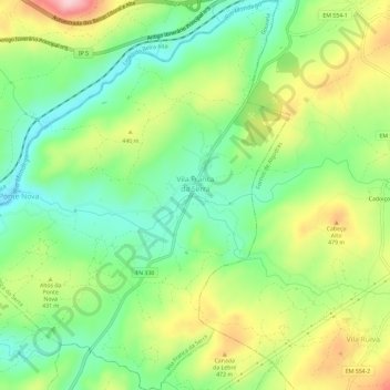
Vila Franca da Serra topographic map
Interactive map
Click on the map to display elevation.
About this map
Name: Vila Franca da Serra topographic map, elevation, terrain.
Location: Vila Franca da Serra, Gouveia, Guarda, Portugal (40.56345 -7.57690 40.60792 -7.52541)
Average elevation: 1,319 ft
Minimum elevation: 1,024 ft
Maximum elevation: 1,775 ft
Other topographic maps
Click on a map to view its topography, its elevation and its terrain.
Serra da Estrela Nature Park
Serra da Estrela Nature Park, Aldeias e Mangualde da Serra, Gouveia, Guarda, 6260-062, Portugal
Average elevation: 2,428 ft