
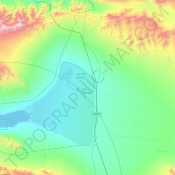
阿伊纳乡 topographic map
Interactive map
Click on the map to display elevation.
About this map
Name: 阿伊纳乡 topographic map, elevation, terrain.
Location: 阿伊纳乡, 阿克塞哈萨克族自治县, 酒泉市, 甘肃省, 736400, 中国 (38.71606 93.41460 39.28927 94.36887)
Average elevation: 10,571 ft
Minimum elevation: 9,157 ft
Maximum elevation: 16,572 ft
Other topographic maps
Click on a map to view its topography, its elevation and its terrain.
阿克塞县
中国 > 甘肃省 > 阿克塞哈萨克族自治县 > 红柳湾镇
阿克塞县, 红柳湾镇, 阿克塞哈萨克族自治县, 酒泉市, 甘肃省, 736400, 中国
Average elevation: 5,984 ft
红崖子
中国 > 甘肃省 > 阿克塞哈萨克族自治县 > 阿勒腾乡
红崖子, 阿勒腾乡, 阿克塞哈萨克族自治县, 酒泉市, 甘肃省, 736400, 中国
Average elevation: 12,175 ft
东格列克村
中国 > 甘肃省 > 阿克塞哈萨克族自治县 > 阿克旗乡
东格列克村, 阿克旗乡, 阿克塞哈萨克族自治县, 酒泉市, 甘肃省, 736400, 中国
Average elevation: 5,531 ft