
Thank you for supporting this site ❤️
Make a donation
Make a donation
Gear up for your next adventure:
As an Amazon Associate, this site earns from qualifying purchases at no extra cost to you.
Alcorisa topographic map
Click on the map to display elevation.
Thank you for supporting this site ❤️
Make a donation
Make a donation
Gear up for your next adventure:
As an Amazon Associate, this site earns from qualifying purchases at no extra cost to you.
About this map
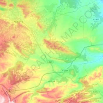
Name: Alcorisa topographic map, elevation, terrain.
Location: Alcorisa, Bajo Aragón, Teruel, Aragon, 44550, Spain (40.86113 -0.47033 41.00579 -0.29001)
Average elevation: 2,244 ft
Minimum elevation: 1,608 ft
Maximum elevation: 3,189 ft
Thank you for supporting this site ❤️
Make a donation
Make a donation
Gear up for your next adventure:
As an Amazon Associate, this site earns from qualifying purchases at no extra cost to you.