
Leeds topographic map
Interactive map
Click on the map to display elevation.
About this map
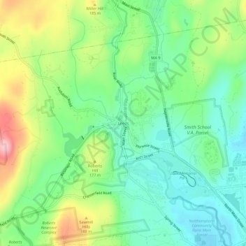
Name: Leeds topographic map, elevation, terrain.
Average elevation: 436 ft
Minimum elevation: 217 ft
Maximum elevation: 853 ft
Other topographic maps
Click on a map to view its topography, its elevation and its terrain.
Florence
United States > Massachusetts > Hampshire County > Northampton
Florence, Northampton, Hampshire County, Massachusetts, 01062, United States
Average elevation: 256 ft