
Gratz topographic map
Interactive map
Click on the map to display elevation.
About this map
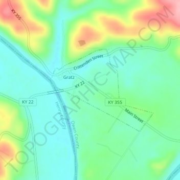
Name: Gratz topographic map, elevation, terrain.
Location: Gratz, Owen County, Kentucky, Estados Unidos da América (38.46549 -84.95638 38.47790 -84.93656)
Average elevation: 568 ft
Minimum elevation: 433 ft
Maximum elevation: 853 ft