
Amélékia topographic map
Interactive map
Click on the map to display elevation.
About this map
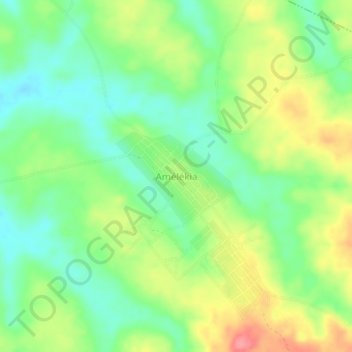
Name: Amélékia topographic map, elevation, terrain.
Location: Amélékia, Abengourou, Indénié-Djuablin, Comoé, Côte d'Ivoire (6.81036 -3.59522 6.85036 -3.55522)
Average elevation: 617 ft
Minimum elevation: 502 ft
Maximum elevation: 784 ft