
Prélager topographic map
Interactive map
Click on the map to display elevation.
About this map
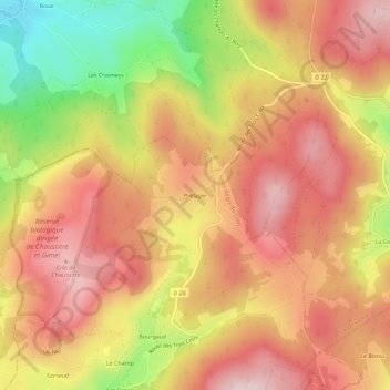
Name: Prélager topographic map, elevation, terrain.
Average elevation: 3,714 ft
Minimum elevation: 3,064 ft
Maximum elevation: 4,127 ft
Other topographic maps
Click on a map to view its topography, its elevation and its terrain.
Fleury
France > Auvergne-Rhône-Alpes > Loire > Saint-Régis-du-Coin
Fleury, Saint-Régis-du-Coin, Saint-Étienne, Loire, Auvergne-Rhône-Alpes, France métropolitaine, 42660, France
Average elevation: 3,556 ft
La Rouchouse
France > Auvergne-Rhône-Alpes > Loire > Saint-Régis-du-Coin
La Rouchouse, Saint-Régis-du-Coin, Saint-Étienne, Loire, Auvergne-Rhône-Alpes, France métropolitaine, 42660, France
Average elevation: 3,612 ft