
Sherrard topographic map
Interactive map
Click on the map to display elevation.
About this map
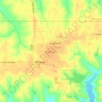
Name: Sherrard topographic map, elevation, terrain.
Location: Sherrard, Mercer County, Illinois, United States (41.31407 -90.51240 41.32430 -90.49768)
Average elevation: 781 ft
Minimum elevation: 709 ft
Maximum elevation: 814 ft