
Santa Gertrudis topographic map
Interactive map
Click on the map to display elevation.
About this map
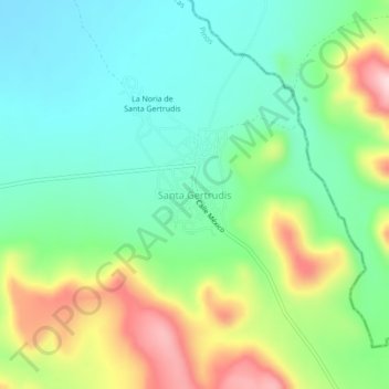
Name: Santa Gertrudis topographic map, elevation, terrain.
Location: Santa Gertrudis, Pinos, Zacatecas, México (22.57920 -101.33656 22.61920 -101.29656)
Average elevation: 6,949 ft
Minimum elevation: 6,660 ft
Maximum elevation: 7,526 ft
Other topographic maps
Click on a map to view its topography, its elevation and its terrain.
Cerro de la Bufa (El Encino)
Cerro de la Bufa (El Encino), Pinos, Zacatecas, México
Average elevation: 7,969 ft