
Wellington topographic map
Interactive map
Click on the map to display elevation.
About this map
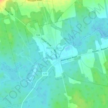
Name: Wellington topographic map, elevation, terrain.
Location: Wellington, Prince County, Isla del Príncipe Eduardo, Canadá (46.44358 -64.01165 46.46140 -63.99057)
Average elevation: 30 ft
Minimum elevation: -7 ft
Maximum elevation: 108 ft