
Nendaz topographic map
Interactive map
Click on the map to display elevation.
About this map
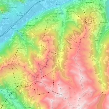
Name: Nendaz topographic map, elevation, terrain.
Location: Nendaz, Conthey, Wallis, 1997, Switzerland (46.06054 7.24951 46.21142 7.36854)
Average elevation: 5,810 ft
Minimum elevation: 1,526 ft
Maximum elevation: 10,889 ft
Other topographic maps
Click on a map to view its topography, its elevation and its terrain.
Pt 1589
Switzerland > Wallis > Conthey > Conthey > Derborence
Pt 1589, Derborence, Conthey, Wallis, 1964, Switzerland
Average elevation: 6,007 ft
Siviez
Switzerland > Wallis > Conthey > Nendaz
Siviez, Nendaz, Conthey, Wallis, 1997, Switzerland
Average elevation: 7,041 ft