Geolocate

Traunstein topographic map

Click on the map to display elevation.

About this map

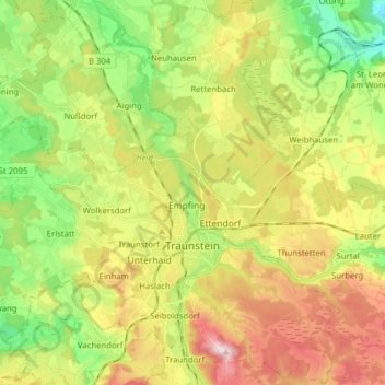
Name: Traunstein topographic map, elevation, terrain.

Location: Traunstein, Landkreis Traunstein, Bavaria, 83278, Germany (47.83208 12.57859 47.93710 12.70266)

Average elevation: 1,972 ft

Minimum elevation: 1,535 ft

Maximum elevation: 2,539 ft

Gear up for your next adventure:

🛏️Cold Weather Sleeping Bag - Warm sleeping bag for cold conditions
🔭Compact Binoculars - HD vision for scouting terrain and identifying distant landmarks
🔥Camping Stove - Portable stove for camping and backcountry cooking
🔦LED Headlamp - Bright and durable LED headlamp for night navigation
🧺Microfiber Travel Towels - Compact and fast-drying towels for trail use

As an Amazon Associate, this site earns from qualifying purchases at no extra cost to you.