
Bromsgrove topographic map
Interactive map
Click on the map to display elevation.
About this map
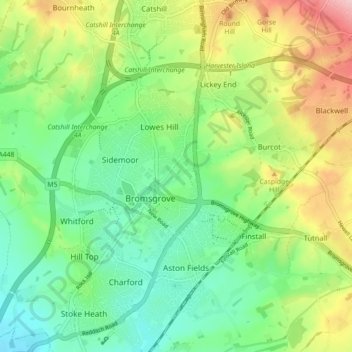
Name: Bromsgrove topographic map, elevation, terrain.
Location: Bromsgrove, Worcestershire, West Midlands, Engeland, VK (52.31151 -2.08468 52.36600 -2.02139)
Average elevation: 390 ft
Minimum elevation: 184 ft
Maximum elevation: 764 ft