Geolocate

Cerro Catedral topographic map

Interactive map

Click on the map to display elevation.

Cerro Catedral

Cerro Catedral ("Cathedral Hill"), also known as Cerro Cordillera, is a peak and the highest point of Uruguay, with an altitude of 513.66 m (1,685.2 ft). It is located north of Maldonado Department, in the municipality of Aiguá, in a hill range named Sierra Carapé, which constitutes part of a larger range named Cuchilla Grande. Its name derived from the curious forms of the rocky elevations of its summit, which are very common in the southern part of this country.

Wikipedia (CC-BY-SA 3.0)

About this map

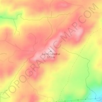
Name: Cerro Catedral topographic map, elevation, terrain.

Location: Cerro Catedral, Maldonado, Uruguay (-34.38292 -54.67416 -34.38282 -54.67406)

Average elevation: 1,362 ft

Minimum elevation: 778 ft

Maximum elevation: 1,683 ft

Other topographic maps

Click on a map to view its topography, its elevation and its terrain.

Pan de Azúcar

Uruguay > Maldonado

Average elevation: 95 ft

Punta Colorada

Uruguay > Maldonado

Average elevation: 39 ft

Punta Del Este

Uruguay > Maldonado

Average elevation: 33 ft

José Ignacio

Uruguay > Maldonado

Average elevation: 33 ft

Punta Del Este

Uruguay > Maldonado

Average elevation: 33 ft

Edén

Uruguay > Maldonado

Average elevation: 253 ft

El Tesoro

Uruguay > Maldonado

Average elevation: 43 ft

Isla de Lobos

Uruguay > Maldonado

Average elevation: 0 ft

Maldonado

Uruguay > Maldonado

Average elevation: 75 ft

El Chorro

Uruguay > Maldonado

Average elevation: 59 ft

Aiguá

Uruguay > Maldonado

The municipality of Aiguá has the highest point of Uruguay, the Cerro Catedral. This point is situated at an altitude of 513.66 metres (1,685.2 ft).

Average elevation: 312 ft

Pan de Azúcar

Uruguay > Maldonado

Average elevation: 95 ft

Ocean Park

Uruguay > Maldonado > Ocean Park

Average elevation: 46 ft

Pinares - Las Delicias

Uruguay > Maldonado

Average elevation: 43 ft