
Temangan topographic map
Interactive map
Click on the map to display elevation.
About this map
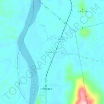
Name: Temangan topographic map, elevation, terrain.
Location: Temangan, Machang, Kelantan, Malaysia (5.69563 102.13430 5.73563 102.17430)
Average elevation: 102 ft
Minimum elevation: 26 ft
Maximum elevation: 692 ft