
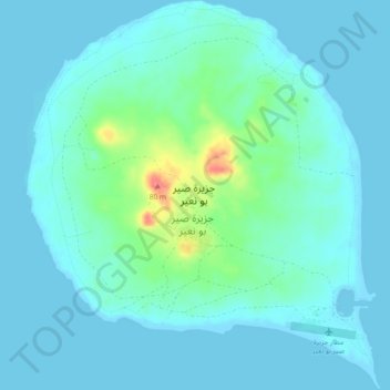
Sir Bu Nuair Island topographic map
Interactive map
Click on the map to display elevation.
About this map
Name: Sir Bu Nuair Island topographic map, elevation, terrain.
Location: Sir Bu Nuair Island, Sharjah, United Arab Emirates (25.21037 54.19793 25.25278 54.24028)
Average elevation: 36 ft
Minimum elevation: -3 ft
Maximum elevation: 223 ft
Other topographic maps
Click on a map to view its topography, its elevation and its terrain.
Sharjah
United Arab Emirates > Sharjah > Sharjah
Sharjah, 20268, United Arab Emirates
Average elevation: 33 ft
Khor Fakkan
United Arab Emirates > Sharjah > Khor Fakkan
Khor Fakkan, Sharjah, United Arab Emirates
Average elevation: 341 ft
Al Badaia
United Arab Emirates > Sharjah > Al Badaia
Al Badaia, Sharjah, United Arab Emirates
Average elevation: 180 ft