
潭门镇 topographic map
Interactive map
Click on the map to display elevation.
About this map
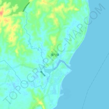
Name: 潭门镇 topographic map, elevation, terrain.
Location: 潭门镇, 琼海市, 海南省, 571431, 中国 (19.20356 110.57151 19.28356 110.65151)
Average elevation: 23 ft
Minimum elevation: -13 ft
Maximum elevation: 131 ft