
Guyton topographic map
Interactive map
Click on the map to display elevation.
About this map
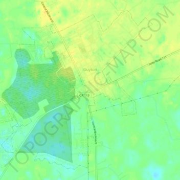
Name: Guyton topographic map, elevation, terrain.
Location: Guyton, Effingham County, Georgia, United States (32.31246 -81.42460 32.35033 -81.37383)
Average elevation: 89 ft
Minimum elevation: 49 ft
Maximum elevation: 125 ft
Other topographic maps
Click on a map to view its topography, its elevation and its terrain.
Springfield
United States > Georgia > Effingham County
Springfield, Effingham County, Georgia, United States
Average elevation: 75 ft
Silverwood Plantation
United States > Georgia > Effingham County > Silverwood Plantation
Silverwood Plantation, Effingham County, Georgia, 31326, United States
Average elevation: 52 ft
Rincon
United States > Georgia > Effingham County
Rincon, Effingham County, Georgia, 31326, United States
Average elevation: 62 ft