
Pemba topographic map
Interactive map
Click on the map to display elevation.
About this map
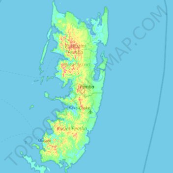
Name: Pemba topographic map, elevation, terrain.
Location: Pemba, Wete District, North Pemba, Zanzibar, Tanzania (-5.47382 39.63170 -4.86436 39.87616)
Average elevation: 13 ft
Minimum elevation: -10 ft
Maximum elevation: 292 ft
Other topographic maps
Click on a map to view its topography, its elevation and its terrain.
Kiwani
Kiwani, Wete District, North Pemba, Zanzibar, Tanzania
Average elevation: 39 ft