
Kampung Seri Lalang Laut topographic map
Interactive map
Click on the map to display elevation.
About this map
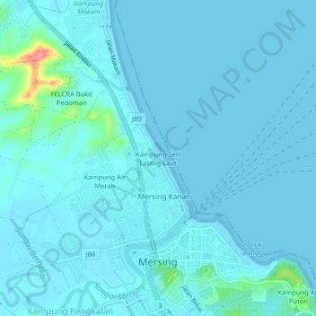
Name: Kampung Seri Lalang Laut topographic map, elevation, terrain.
Location: Kampung Seri Lalang Laut, Mersing, Johor, 86800, Malaysia (2.42293 103.81551 2.46293 103.85551)
Average elevation: 23 ft
Minimum elevation: -3 ft
Maximum elevation: 299 ft
Other topographic maps
Click on a map to view its topography, its elevation and its terrain.
Kampung Air Merah
Kampung Air Merah, Mersing, Johor, 86800, Malaysia
Average elevation: 33 ft
Sungai Mersing
Sungai Mersing, Mersing, Johor, 86807, Malaysia
Average elevation: 43 ft
Sungai Jamari
Sungai Jamari, Mersing, Johor, Malaysia
Average elevation: 33 ft