
Crête du Chenil topographic map
Interactive map
Click on the map to display elevation.
About this map
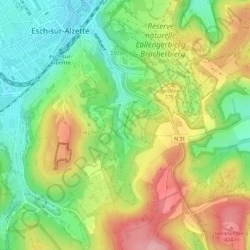
Name: Crête du Chenil topographic map, elevation, terrain.
Average elevation: 1,158 ft
Minimum elevation: 945 ft
Maximum elevation: 1,421 ft
Other topographic maps
Click on a map to view its topography, its elevation and its terrain.
Park
Luxembourg > Canton Esch-sur-Alzette > Esch-sur-Alzette
Park, Esch-sur-Alzette, Canton Esch-sur-Alzette, Luxembourg
Average elevation: 1,175 ft