
Somoto topographic map
Interactive map
Click on the map to display elevation.
About this map
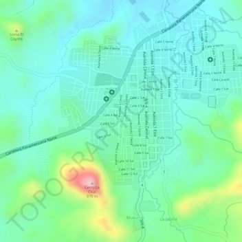
Name: Somoto topographic map, elevation, terrain.
Location: Somoto, Somoto (Municipio), Madriz, 34000, Nicaragua (13.46643 -86.59225 13.49123 -86.56914)
Average elevation: 2,369 ft
Minimum elevation: 2,188 ft
Maximum elevation: 2,877 ft
Ein bis zehn Kilometer nördlich der Panamericana liegt auf der Höhe von Somoto ein Zufluss des Rio Coco, der Cañón de Somoto.
Other topographic maps
Click on a map to view its topography, its elevation and its terrain.
Río Tapacalí
Nicaragua > Madriz > Las Sabana (Municipio)
Río Tapacalí, Las Sabana (Municipio), San Lucas (Municipio), Madriz, 35500, Nicaragua
Average elevation: 3,579 ft