
Taysan topographic map
Interactive map
Click on the map to display elevation.
About this map
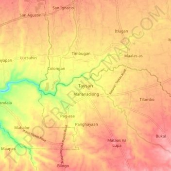
Name: Taysan topographic map, elevation, terrain.
Location: Taysan, Batangas, Calabarzon, 4228, Philippines (13.75769 121.14899 13.83769 121.22899)
Average elevation: 407 ft
Minimum elevation: 102 ft
Maximum elevation: 571 ft
Other topographic maps
Click on a map to view its topography, its elevation and its terrain.
Laurel
Philippines > Batangas > Taysan > Laurel
Laurel, Taysan, Batangas, Calabarzon, Philippines
Average elevation: 630 ft