
Esponellà topographic map
Interactive map
Click on the map to display elevation.
About this map
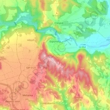
Name: Esponellà topographic map, elevation, terrain.
Location: Esponellà, Plaine de l'Estagne, Gérone, Catalogne, Espagne (42.14956 2.76549 42.18984 2.84906)
Average elevation: 581 ft
Minimum elevation: 276 ft
Maximum elevation: 902 ft
Other topographic maps
Click on a map to view its topography, its elevation and its terrain.
Banyoles
Espagne > Catalogne > Plaine de l'Estagne
Banyoles, Plaine de l'Estagne, Gérone, Catalogne, 17820, Espagne
Average elevation: 610 ft