Geolocate

Santa Maria topographic map

Click on the map to display elevation.

About this map
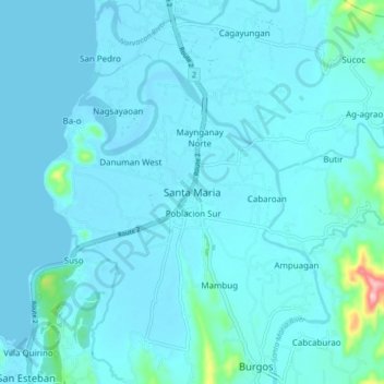
Name: Santa Maria topographic map, elevation, terrain.

Location: Santa Maria, Ilocos Sur, Ilocos Region, 2705, Philippines (17.32986 120.44082 17.40986 120.52082)

Average elevation: 49 ft

Minimum elevation: -3 ft

Maximum elevation: 669 ft

Other topographic maps

Click on a map to view its topography, its elevation and its terrain.
Bessang Pass

Philippines > Ilocos Sur

Average elevation: 4,518 ft

Gear up for your next adventure:

🛰️Handheld GPS Units - Professional satellite navigators for precise backcountry mapping
🎒Day Hiking Backpack - Lightweight backpack perfect for day trips and outdoor adventures
🧴Hand Sanitizer - Keep hands clean while hiking
🏥Hiking First Aid Kits - Comprehensive medical kits for remote trail injuries
🧭Map Reading Tools - Tools and kits for map navigation

As an Amazon Associate, this site earns from qualifying purchases at no extra cost to you.