
Sequoyah topographic map
Interactive map
Click on the map to display elevation.
About this map
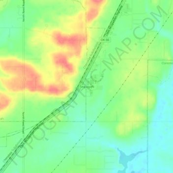
Name: Sequoyah topographic map, elevation, terrain.
Location: Sequoyah, Rogers County, Oklahoma, USA (36.35343 -95.58081 36.39343 -95.54081)
Average elevation: 689 ft
Minimum elevation: 597 ft
Maximum elevation: 817 ft
Other topographic maps
Click on a map to view its topography, its elevation and its terrain.
Lake Claremore
Lake Claremore, East 465, Sequoyah, Rogers County, Oklahoma, 74017, USA
Average elevation: 653 ft