
Matavai topographic map
Interactive map
Click on the map to display elevation.
About this map
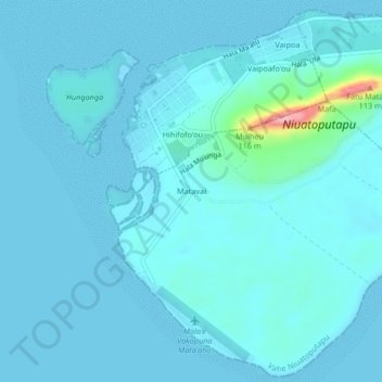
Name: Matavai topographic map, elevation, terrain.
Location: Matavai, Pule'anga, Vahe Niuatoputapu, Ongo Niua, Tonga (-15.98304 -173.81263 -15.94304 -173.77263)
Average elevation: 39 ft
Minimum elevation: -7 ft
Maximum elevation: 502 ft
Other topographic maps
Click on a map to view its topography, its elevation and its terrain.
'Alele'uta
'Alele'uta, 'Esia, Vahe Niuafo'ou, Ongo Niua, Tonga
Average elevation: 115 ft