
Pulau Mangole topographic map
Interactive map
Click on the map to display elevation.
About this map
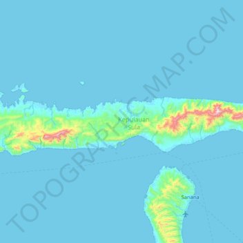
Name: Pulau Mangole topographic map, elevation, terrain.
Location: Pulau Mangole, Kabupaten Kepulauan Sula, Malut, Indonesia (-2.17835 125.47791 -1.53835 126.11791)
Average elevation: 141 ft
Minimum elevation: 0 ft
Maximum elevation: 3,553 ft
Other topographic maps
Click on a map to view its topography, its elevation and its terrain.