Geolocate

Gosselies topographic map

Click on the map to display elevation.

About this map
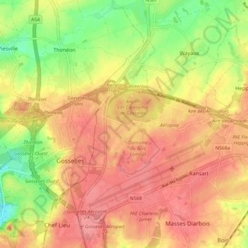
Name: Gosselies topographic map, elevation, terrain.

Location: Gosselies, Charleroi, Hainaut, Wallonia, 6041, Belgium (50.45469 4.39730 50.49243 4.48489)

Average elevation: 495 ft

Minimum elevation: 341 ft

Maximum elevation: 620 ft

Other topographic maps

Click on a map to view its topography, its elevation and its terrain.

Terril du Martinet

Belgium > Hainaut > Charleroi > Charleroi

Average elevation: 436 ft

Gear up for your next adventure:

🎒Gear Packing Cubes - Organize your backpack efficiently
🔥Plasma Lighters - Windproof lighters that work in any weather condition
🪶Camp Gear Gift Set - Perfect gift bundle for outdoor fans
🧴Hand Sanitizer - Keep hands clean while hiking
🧭Compass with Lanyard - Easy‑carry compass for navigation

As an Amazon Associate, this site earns from qualifying purchases at no extra cost to you.